
+ SITE PLANS
Draw a site plan for your building permit
Most building permits start with a site plan. AI CAD PRO is free plot plan software for Windows: attach your survey or plat, describe what you’re building, and the AI assistant helps you draw a dimensioned site plan you can edit by hand.
FREE TO USE / WINDOWS / RUNS ON YOUR CHATGPT SUBSCRIPTION
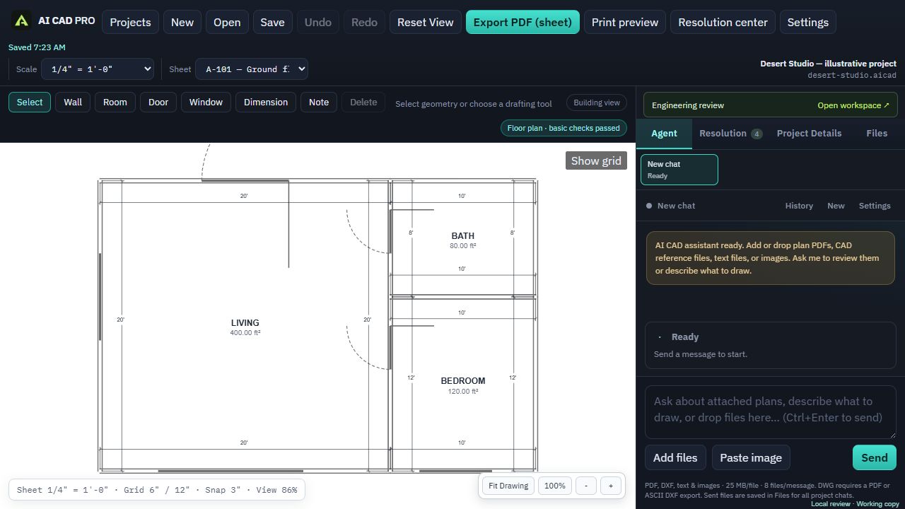
What a site plan for a building permit shows
A site plan (often called a plot plan) is a bird’s-eye drawing of your lot. It tells the reviewer where the new work goes and whether it fits the rules. Most building departments want to see:
- Property lines with their dimensions, and the street
- A north arrow and the drawing scale
- Existing and proposed buildings, labeled and dimensioned
- Setbacks: the distance from each building to each property line
- Easements and rights-of-way
- The driveway, and utilities like power, water, gas and sewer
- Septic tank and drain field, or well, if you have them
- Drainage, and lot coverage where the zoning code limits it
Our step-by-step guide, how to draw a site plan, explains each of these and where to find the information.
Start from your survey or plat
A good site plan starts with good parcel information. The best source is a boundary survey. If you don’t have one, the recorded plat for your subdivision or your county’s parcel records are the usual places to look.
Attach the survey or plat as a PDF, and the assistant uses it as a reference for the property lines and dimensions. Scanned documents can be hard to read, so check every line and distance against the original. You know your lot better than any file does.
AI CAD PRO accepts PDFs, images, ASCII DXF files, and text or CSV files as references. It can’t open DWG files, so ask your surveyor for a PDF or an ASCII DXF.
Drawing it with the assistant
Describe what goes where, in the same words you’d use with a contractor:
- “Draw the lot from the attached survey, with a north arrow and the street along the south line.”
- “Place the new 24 by 30 foot garage 15 feet from the rear property line and dimension all setbacks.”
- “Show the septic tank and drain field from the attached septic permit drawing.”
- “Add the gravel driveway from the road to the garage door.”
The assistant draws property lines, buildings, dimensions and notes as real CAD objects. Use polylines, polygons, hatching and leaders for driveways, easements and landscaped areas. Everything stays editable, so you can nudge a building or retype a distance yourself.
Plot plan software you can reuse
Your lot doesn’t change much between projects. Draw it once, and when you come back next year for the shed, the solar array or the workshop, ask the assistant to copy the plot plan from your earlier project into the new one. Then add the new building and update the setbacks.
Your projects are saved on your computer, so the plot plan is always there when you need it.
Getting the details right
Site plans get sent back for small things: a missing setback, an unlabeled easement, a distance nobody can read. The Resolution center lists missing information and plan warnings, recommends what to do, and tells you where to find the information. Drafting checks catch overlapping annotations and notes that overflow their space.
Print preview matches the PDF, so you can check that every dimension is readable at the paper size you’ll submit. Export on Letter, Tabloid or Arch D paper as part of a coordinated sheet set.
What a site plan can’t do
A site plan you draw isn’t a survey. It doesn’t establish where your property lines are, and AI CAD PRO doesn’t determine them for you. If you’re building close to a setback line, your building department may require a survey. The software also doesn’t check your plan against the zoning code, and it doesn’t supply grading or drainage engineering. Your permitting office decides what it needs.
GOOD QUESTIONS
Questions, answered.
Is a site plan the same as a plot plan?
Mostly. Many building departments use the terms interchangeably for a drawing of your lot with property lines, buildings and setbacks. Some use plot plan for a simpler drawing and site plan for one that adds grading, drainage and utilities. Follow your permit office’s checklist.
Do I need a survey to draw a site plan?
Not always. Many permit offices accept a site plan drawn from a recorded plat or county parcel map for simple projects, while others require a survey, especially when you build close to a setback line. Ask before you start.
Is the plot plan software free?
Yes. AI CAD PRO is free to download and free to use on Windows. The AI assistant runs on your own ChatGPT subscription.
Can I reuse my site plan for another project?
Yes. Ask the assistant to copy the plot plan from another saved project, then add the new work.
FREE FOR WINDOWS
Draw your site plan today.
Download AI CAD PRO for Windows, attach your survey or plat, and describe what you’re building. It’s free to download and free to use.
Windows 64-bit · Works with your ChatGPT subscription